QGIS Python Programming Techniques
QGIS Python Programming Techniques
MP4 | Video: AVC 1280x720 | Audio: AAC 44KHz 2ch | Duration: 3 Hours | 645 MB
Genre: eLearning | Language: English
MP4 | Video: AVC 1280x720 | Audio: AAC 44KHz 2ch | Duration: 3 Hours | 645 MB
Genre: eLearning | Language: English
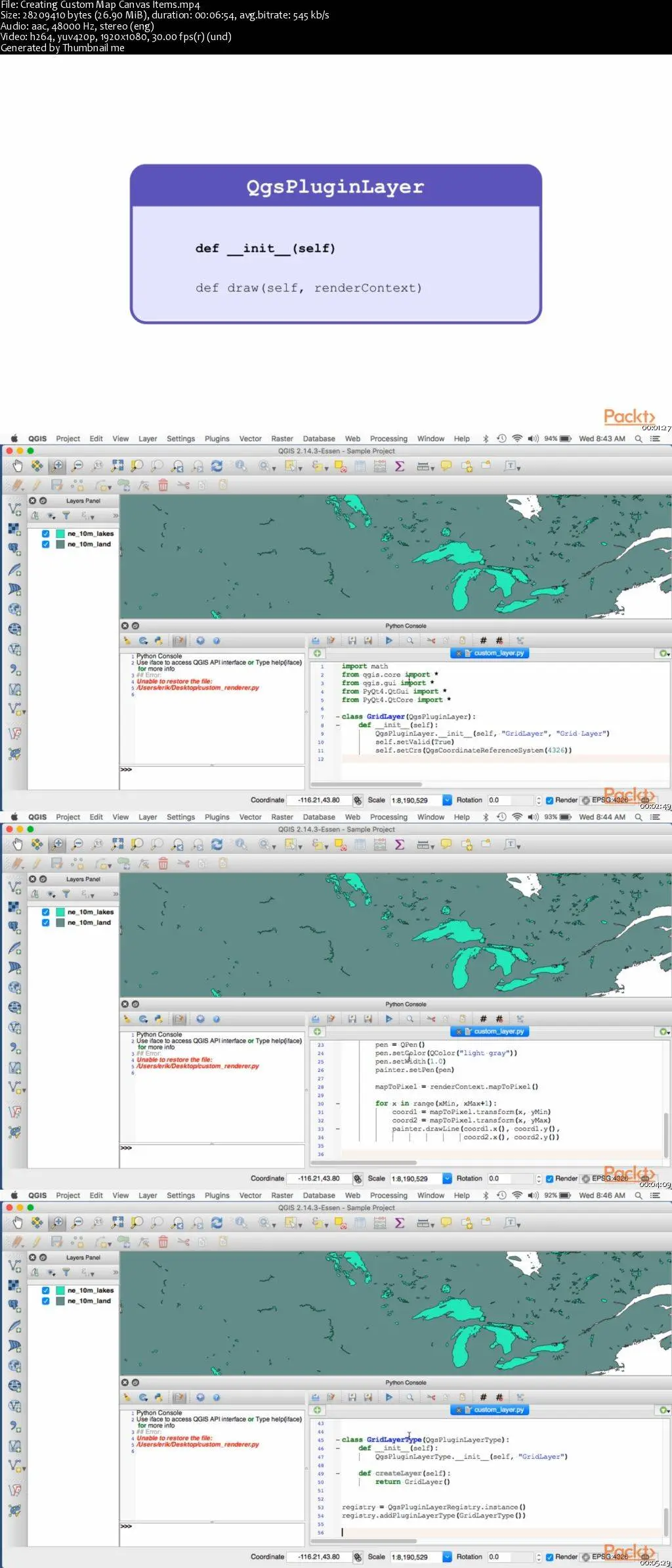
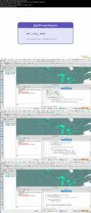
Using the more advanced aspects of the QGIS geographical information system, this video course shows how to build sophisticated geospatial applications using Python. Geospatial applications are often very complicated; using QGIS, however, you can avoid a lot of this complexity by developing at a higher level, making use of the many viewing tools and analyzing and editing geospatial data provided by the QGIS system. Using these tools, you can build more sophisticated geospatial applications with less time and effort.
The course starts with an in-depth look at the QGIS Python API, concentrating on how this library can be used to display information on a map. We then look at how external applications that use the PyQGIS library can let the user select and edit geospatial features. We go on to use the knowledge we have gained to implement a sophisticated turnkey mapping system called ForestTrails. This application includes the ability to add, edit, and delete “tracks” on top of a detailed basemap, and lets you find the shortest path between two points by following the network of tracks. This example will serve as a springboard for the user’s own developmental efforts, as well as being a complete and very useful program in its own right.
QGIS Python Programming Techniques