

Land Cover Classification In Google Earth Engine

Land Cover Classification In Google Earth Engine
Published 5/2025
MP4 | Video: h264, 1920x1080 | Audio: AAC, 44.1 KHz
Language: English | Size: 889.42 MB | Duration: 1h 10m
Published 5/2025
MP4 | Video: h264, 1920x1080 | Audio: AAC, 44.1 KHz
Language: English | Size: 889.42 MB | Duration: 1h 10m
Start applying machine learning for remote sensing
What you'll learn
Get Theoretical Knowledge of Random Forest Algorithm
Proficiency in Google Earth Engine
Training Data Development
Land Cover Mapping
Accuracy Assessment
Requirements
A free Google Earth Engine account (enrollment instructions provided)
Access to a computer with a reliable internet connection
Description
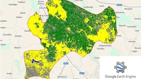
Welcome to an in-depth and rigorously structured course designed to equip learners with the expertise to perform land cover classification using Random Forest within Google Earth Engine (GEE). This course is tailored for students, geospatial professionals, environmental scientists, and researchers seeking to harness satellite imagery for precise land cover mapping. Through a comprehensive case study in Çumra District, Konya, Türkiye, participants will develop proficiency in classifying land into four categories—Water, Vegetation, Urban, and Bare Land—utilizing state-of-the-art machine learning techniques and cloud-based geospatial platforms. No prior experience in coding or remote sensing is required, as this course provides a systematic progression from foundational concepts to advanced applications, ensuring accessibility for beginners and value for experienced learners.Upon completion, you will produce a professional-grade land cover map of Çumra District, demonstrating mastery of Random Forest and GEE. You will gain the ability to preprocess satellite imagery, develop and validate machine learning models, and interpret geospatial data, skills highly valued in academia and industries such as environmental management, urban planning, and agricultural monitoring.Embark on a transformative learning journey to master land cover classification with Random Forest in Google Earth Engine. This course offers a unique opportunity to develop cutting-edge skills through a practical, real-world project in Çumra District, equipping you to address global environmental challenges. Enroll now to gain expertise in geospatial analysis, contribute to sustainable development. Begin your journey today and unlock the potential of satellite imagery to map and understand our world.
Overview
Section 1: Introduction
Lecture 1 What is Google Earth Engine?
Lecture 2 Google Earth Engine Interface
Lecture 3 Landsat 8 Image Visualization
Section 2: Random Forest Algorithm
Lecture 4 What is Random Forest?
Lecture 5 Overfitting
Section 3: Land Cover Classification
Lecture 6 Create Training Dataset
Lecture 7 Combine Training Points
Lecture 8 Choose Features
Lecture 9 Get Feature Values
Lecture 10 Split Data for Training and Testing
Lecture 11 Train Random Forest
Lecture 12 Classify the Image
Lecture 13 Land Cover Mapping
Lecture 14 Potential Questions and Answers
Section 4: Accuracy Assesment
Lecture 15 Intro
Lecture 16 Classify the Validation Set
Lecture 17 Create a Confusion Matrix
Lecture 18 Potential Questions and Answers
Undergraduate and graduate students in environmental science, geography, or related fields seeking practical geospatial skills,Geospatial professionals aiming to integrate machine learning and GEE into their workflows.,Researchers and analysts interested in leveraging satellite imagery for environmental and urban studies