

Groundwater Exploration & Study Focus On Electrical Methods

Groundwater Exploration & Study Focus On Electrical Methods
Published 7/2025
MP4 | Video: h264, 1920x1080 | Audio: AAC, 44.1 KHz
Language: English | Size: 1.69 GB | Duration: 4h 6m
Published 7/2025
MP4 | Video: h264, 1920x1080 | Audio: AAC, 44.1 KHz
Language: English | Size: 1.69 GB | Duration: 4h 6m
A comprehensive curriculum on the systematic application of geoelectrical methods, from survey design and data inversion
What you'll learn
Practicing Geologists and Hydrogeologists
Civil, Geotechnical, and Water Resource Engineers
Environmental Scientists and Consultants
Graduate and Senior Undergraduate Students
Project Managers and Decision-Makers
Professional Drilling Companies and Consultants
Requirements
A foundational understanding of basic geology or earth science concepts.
Description
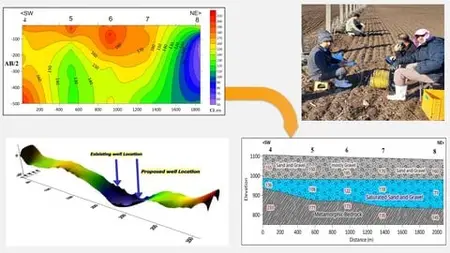
In the field of resource management, uncertainty poses the greatest financial and operational risk. The process of locating subsurface water resources, in particular, has historically been subject to imprecise methods and speculative drilling, often resulting in significant economic loss. Modern geophysics offers a scientific and data-driven alternative.This course provides a comprehensive and professional-level training on the industry-standard method for groundwater characterization: Electrical Resistivity.My name is Hosein Moghaddasi. I am a geophysicist with a Master of Science degree from the Institute of Geophysics, University of Tehran. For over twelve years, my professional activities have been centered on subsurface exploration. As co-founder of Jarfab Kavosh Consulting Co., my team and I have successfully executed over 300 geophysical projects focused on groundwater and mineral resource mapping.The curriculum presented here is a direct codification of the systematic workflow we employ in our professional practice. It is built upon a foundation of rigorous geophysical theory but is focused entirely on practical, real-world application.You will learn the complete professional workflow: from designing a field survey and ensuring data quality, through the computational process of data inversion, to the final and most critical step: rigorous hydrogeological interpretation. While our primary focus is mastering electrical resistivity, we will also explore how complementary methods like seismic and electromagnetics are integrated to reduce ambiguity and build a truly robust subsurface model.This course is distinguished by its extensive use of case studies and datasets from our professional archives, offering you unparalleled insight into real-world projects. It is designed for geologists, engineers, environmental scientists, and students who wish to attain a professional level of competency in the application of geoelectrical methods for groundwater studies.Enroll to advance your technical expertise and adopt a methodology that replaces speculation with scientific certainty.
Overview
Section 1: Introduction - The Quest for Hidden Water
Lecture 1 Introduction
Lecture 2 Introduction to Groundwater & Hydrogeophysics
Lecture 3 What is Groundwater and Why is Exploration Vital?
Section 2: Understanding Aquifers
Lecture 4 Aquifers - The Basics
Lecture 5 Understanding Aquifers
Lecture 6 Aquifer Types (Simplified)
Lecture 7 Aquifers - Porous Media
Lecture 8 Aquifers - Hard Rock Formations
Section 3: Geological Factors in Exploration
Lecture 9 Geology is Key!
Lecture 10 Geological Factors in Exploration - Porous Media Targets
Lecture 11 Geological Factors in Exploration - Hard Rock Targets
Lecture 12 The Importance of Correctly Understanding Dimensionality and Geological Analysis
Section 4: What is Hydrogeophysics?
Lecture 13 What is Hydrogeophysics?
Section 5: Fundamentals of Electrical Geophysics
Lecture 14 Electrical Resistivity Method
Lecture 15 Basic Concepts of Electrical Resistivity
Section 6: From Physics to Field Measurement
Lecture 16 What Controls Earth's Resistivity?
Lecture 17 Typical Resistivity Values
Lecture 18 Apparent vs. True Resistivity
Lecture 19 The 4-Electrode System
Lecture 20 Geometric Factor (k)
Section 7: The Workhorse Method: 1D Vertical Electrical Sounding (VES)
Lecture 21 Common VES Arrays: Schlumberger
Lecture 22 Advantages, limitations, and disadvantages of Vertical Electrical Sounding (VES)
Lecture 23 Common VES Arrays: Wenner
Lecture 24 Other geoelectrical arrays
Lecture 25 1D Resistivity Sounding (VES) - Probing with Depth
Lecture 26 Depth of Investigation (DOI)
Lecture 27 Influence of Resistivity Contrast
Lecture 28 Conceptual Question 1
Section 8: 1D Field Acquisition & Data Quality
Lecture 29 1D Field Acquisition
Lecture 30 Planning the Survey - Site & Line
Lecture 31 Planning - Array & Spacing
Lecture 32 Field Procedure: Schlumberger VES (Steps)
Lecture 33 Data Quality Control (QC) in the Field
Lecture 34 Common Field Issues & Troubleshooting
Section 9: Data Processing and Inversion
Lecture 35 1D Data Processing & Inversion
Lecture 36 Example VES curve
Lecture 37 What is a Pseudosection?
Lecture 38 Pseudosection vs. Inverted Section
Lecture 39 The Concept of Inversion And Iterative Approach
Lecture 40 RMS Error - Quantifying the Fit
Section 10: From Model to Meaning: Interpretation & Case Studies
Lecture 41 Software Demo – 1D Inversion Workflow
Lecture 42 True resistivity cross-section obtained from inversion
Lecture 43 3D hydrogeological block based on inverted true resistivity profiles
Section 11: Limitations & Challenges For VES
Lecture 44 VES Limitations & Challenges
Lecture 45 VES Limitations-Equivalence And Etalonage
Lecture 46 Suppression - Hiding Thin Layers
Section 12: The 1D Assumption & Implications and How Can Minimize Errors?
Lecture 47 The 1D Assumption & Implications and How Can Minimize Errors?
Lecture 48 Direction of Array Expansion for VES For delineating Bedrock topography
Lecture 49 Direction of Array Expansion for VES If Permeability Trend Is Key
Section 13: Connecting Resistivity to Hydrogeology in 1
Lecture 50 Primary Goal
Lecture 51 Calibration
Lecture 52 Estimating Water Quality (Salinity/EC/TDS)
Lecture 53 Conceptual Question 2
Section 14: Real example
Lecture 54 Mashhad Water Supply
Section 15: Beyond 1D - Imaging the Earth with ERT
Lecture 55 Why Move Beyond 1D?
Lecture 56 Electrical Resistivity Tomography, or ERT
Lecture 57 Introduction to 4D Imaging (Time-Lapse ERT)
Lecture 58 Data Acquisition for 2D/3D ERT
Lecture 59 Data Processing & Inversion (2D/3D)
Lecture 60 Combining IP and resistivity surveys
Lecture 61 Considerations for 2D/3D ERT
Lecture 62 Advantages of 2D/3D ERT over VES
Lecture 63 ERT Software Overview
Lecture 64 ERT vs. VES - Pros & Cons
Section 16: Connecting Resistivity to Hydrogeology in 2D
Lecture 65 2D Geoelectrical Studies in Alluvial Environments
Lecture 66 Mapping Contaminant Plumes
Section 17: Integrated Geophysics - Combining Methods for Clearer Results
Lecture 67 Time-Domain Electromagnetic (TDEM / TEM) Method
Lecture 68 Seismic Methods
Lecture 69 Seismic Waves Classification
Lecture 70 Typical Seismic Velocities
Lecture 71 Seismic Refraction
Lecture 72 Seismic Reflection
Lecture 73 Passive Seismic methods
Lecture 74 HVSR
Lecture 75 Passive Seismic Methods For Measuring Shear Wave Velocity (Vs)
Lecture 76 Nuclear Magnetic Resonance (NMR)
Lecture 77 Ground Penetrating Radar (GPR)
Section 18: Putting It All Together - The Complete Workflow
Lecture 78 Planning a Groundwater Project
Lecture 79 Designing the Survey Layout
Lecture 80 Using Borehole Data Effectively
Lecture 81 Future Trends & Further Study
Lecture 82 Resources for Further Learning
Lecture 83 Thank You
Geologist or Hydrogeologist seeking to master a critical geophysical method and elevate your professional practice from qualitative assessment to quantitative, data-driven exploration. Civil, Geotechnical, or Water Resource Engineer who requires reliable subsurface characterization for projects involving water supply, infrastructure design, and sustainable resource management. Environmental Scientist or Consultant engaged in groundwater mapping, resource assessment, or the delineation of contaminant plumes, who needs a robust tool for subsurface investigation. Graduate or Senior Undergraduate Student in Geosciences, Environmental Science, or Engineering who wishes to bridge the gap between academic theory and the practical, field-based skills demanded by the industry. Project Manager or Decision-Maker in the water, mining, and construction sectors who needs to understand the principles behind modern exploration techniques to better manage projects and assess technical reports. Professional Drilling Company or Consultant aiming to significantly improve well-siting success rates by integrating scientific geophysical methods into your operational workflow.