


Course On Complete Geostatistical Modeling
Course On Complete Geostatistical Modeling
Published 5/2025
MP4 | Video: h264, 1920x1080 | Audio: AAC, 44.1 KHz
Language: English | Size: 1.49 GB | Duration: 2h 4m
Published 5/2025
MP4 | Video: h264, 1920x1080 | Audio: AAC, 44.1 KHz
Language: English | Size: 1.49 GB | Duration: 2h 4m
Step-by-Step Guide to Spatial Data Analysis and Kriging
What you'll learn
Learn geostatistics to analyze spatial data, solve real-world problems, and stand out in mining, environment, and smart farming jobs.
Geostatistics is a rare skill. Companies want experts who can model spatial data and handle uncertainty.
Learn tools like R, and QGIS to analyze spatial data, predict trends, and create maps.
With geostatistics, you stand out in the job market and open doors to roles that require smart decision-making using location-based data.
Job oriented course
Requirements
Simple PC or Laptop and dedication to learn.
Description
This course is designed to help students, researchers, and professionals understand and apply geostatistical methods for groundwater modeling. It covers the entire workflow—from data preparation to final visualization—using simple, practical steps.Through this course, learners will gain essential skills in data analysis, spatial modeling, and geostatistics, which are important for groundwater assessment and environmental planning. Whether you're a beginner or someone with basic GIS knowledge, this course will guide you through each stage with clear explanations and examples.What You Will Learn:Groundwater Data Cleaning and Preparation:Learn how to clean, organize, and prepare groundwater datasets using R programming. You will also convert spatial coordinates to UTM format for accurate spatial analysis.Exploratory Data Analysis (EDA):Use plots and summary statistics in R (such as histograms, box plots, and scatter plots) to explore patterns, trends, and outliers in groundwater data.Normality Check and Data Transformation:Understand the importance of data normality in modeling. Learn how to test for normality and apply transformations (e.g., log or z-score) to make data suitable for analysis.Polynomial Trend Surface Analysis:Detect large-scale spatial trends using polynomial regression in R. Remove the trend, perform analysis on residuals, and then add the trend back for accurate final outputs.Variogram and Semivariogram Modeling:Learn to construct variograms and semivariograms to study spatial correlation. Use this knowledge to understand how groundwater levels vary with distance and direction.Grid Creation and Block Kriging:Prepare spatial grids (e.g., 1 km × 1 km) and perform block kriging in R to estimate groundwater levels and uncertainty across the study area.Cross-Validation Techniques:Apply Point Kriging Cross Validation (PKCV) to evaluate model accuracy and choose the most reliable semivariogram model.Statistical Modeling and Interpretation:Develop and apply statistical models (like regression and kriging) using R. Learn how to interpret model parameters and results, understand uncertainty, and extract meaningful insights.Visualization and Interpretation:Use QGIS to create professional maps showing estimated groundwater levels and kriging variance. Learn how to interpret spatial patterns for research, planning, and decision-making.Integration of R and QGIS:Combine the power of R for analysis and QGIS for mapping. Learn a complete, real-world geostatistical modeling workflow using both tools together.Course Benefits:Easy to understand: Concepts explained in simple and clear languagePractical focus: Real-world workflow followed by professionalsComprehensive learning: Covers all major steps in geostatistical groundwater modelingDecision-making support: Learn how to interpret maps and make informed decisionsJob-ready skills: Useful for careers in hydrogeology, environmental science, GIS, and civil engineering
Overview
Section 1: Introduction
Lecture 1 Important and Essential Definition on Geostatistics
Lecture 2 Data Information
Lecture 3 R and RStudio: Installation & Code Explained
Section 2: Expletory Data Analyses (EDA) and Statistical Modeling
Lecture 4 Exploratory Data Analyses (EDA) and Statistical Modeling
Section 3: Geostatistical Modeling
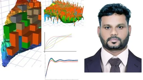
Lecture 5 Semi-variogram Modeling
Lecture 6 Fitted semi-variogram model using Point Kriging Cross Validation technique
Lecture 7 Fitted semi-variogram model using Shiny app
Section 4: Block Kriging
Lecture 8 Grid Construction
Lecture 9 Block Kriging
Lecture 10 Block Kriging Modeling
This course is made for anyone who wants to learn geostatistical modeling and build a successful career by solving real-world problems. Whether you are a student, graduate, or working professional, this course will help you gain valuable, job-ready skills. Students and Graduates (from Geology, Environmental Science, Geography, or Data Science backgrounds): You will learn key concepts like kriging, variograms, and spatial analysis to build strong foundations for a professional career. Working Professionals (in Mining, Oil and Gas, Agriculture, and Environmental sectors): You will learn to apply geostatistics to find natural resources, map pollution, improve urban planning, and practice smarter farming. Data Scientists and Analysts: You will expand your toolkit by adding spatial data skills and working with tools such as QGIS, ArcGIS, and R to analyze location-based data. Researchers and Academics: You will be able to use advanced geostatistical methods for publishing high-quality research, planning fieldwork, and modeling natural systems.