

Early Geological Maps of Europe
Early Geological Maps of Europe: Central Europe 1750 to 1840
Springer | Historical Geology | July 26, 2016 | ISBN-10: 3319224875 | 153 pages | pdf | 24.6 mb
Springer | Historical Geology | July 26, 2016 | ISBN-10: 3319224875 | 153 pages | pdf | 24.6 mb
Authors: Kozák, J., Čejchanová, A., Kukal, Z., Pošmourný, K.
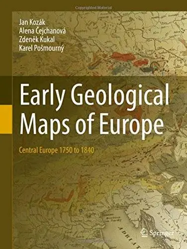
Includes interesting illustrations of 55 old geological maps in full colour
The first work of this type for the region
Unique collection of geological maps from the 18th and 19th centuries
Written by a leading expert in the field
Discusses the importance of geological mapping for the development of human society
This book focuses on the presentation and evaluation of geological maps of the Central Europe from 1750 up to 1840. Milestones in presentation of stratigraphy and tectonics and new geological models on such maps will be underlined. Map descriptions contain fundamentals editorial data as well as the map author’s affiliation and biographies. It represents for the region of the Central Europe the first work of this type. Geological maps represent geological synthesis and indicate the level of geological knowledge throughout history. They serve as guidelines for an economic utilization of mineral deposits and further geological investigation.
Number of Illustrations and Tables
29 b/w illustrations, 58 illustrations in colour
Topics
Popular Earth Science
Historical Geology
Landscape, Regional and Urban Planning
Popular Science in Nature and Environment
History, general
Physical Geography
Click Here to Buy the Hardcover from Springer
Click Here for More books