


EIVA NaviModel Analyser 4.10.1
EIVA NaviModel Analyser 4.10.1 | 887 Mb
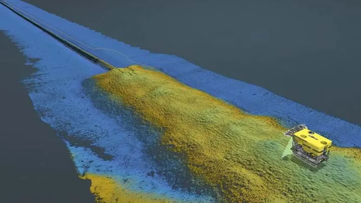
NaviModel offers high-performance digital terrain models in 2D and 3D and high-tech tools for model analyses and manipulations. This includes carrying out comparison over time by visualising the development between different datasets from the same site, acquired at different points in time – what we call 4D.
The NaviModel Analyser variant allows you to process, combine, visualise and analyse the delivered data from subsea inspection service companies. It is tailored to companies who would like to obtain and record as much information as possible from the data they have on their offshore sites and structures.
NaviModel in action with our customers
Featuring our customers’ own experiences with NaviModel in real-world settings, these case studies deliver valuable insights about how and where it can be adopted, deployed and utilised.
Get more intelligence out of your data sets
With NaviModel Analyser, you can carry out volume and distance calculation, as well as generate digital terrain models and cross profiles.
General visualisation tools
NaviModel and NaviPac share the same 3D engine, and therefore the same powerful 3D visualisation features. Data can be visualised in 2D, 3D, side view or by time.
Sensor processing
NaviEdit can be used to recalculate data very quickly and where our sensor processing takes place. Here we change offsets, C-O’s, mounting angles, apply tide, apply SVP, de-spike sensors, improve object positioning, Kalman filtering, remove swell etc.
DTM tools
In NaviSuite Digital Terrain Models (DTMs) can be generated, manipulated, and edited with the help of various tools.
Engineering/Construction Design
Within NaviModel, we can design trench or rock-placement profiles or import existing engineering drawings from various sources (AutoCAD).
Optional extra services and special offers
EIVA offers a number of services for our NaviSuite software users.
Home Page - https://www.eiva.com/